Geolocate

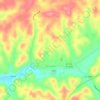
Tyner topographic map

Click on the map to display elevation.

About this map

Name: Tyner topographic map, elevation, terrain.

Location: Tyner, Jackson County, Kentucky, 40486, United States (37.32537 -83.92409 37.36537 -83.88409)

Average elevation: 1,253 ft

Minimum elevation: 1,083 ft

Maximum elevation: 1,378 ft

Jackson County trails, hiking, mountain biking, running and outdoor activities

Other topographic maps

Click on a map to view its topography, its elevation and its terrain.
McKee

United States > Kentucky > Jackson County

Average elevation: 1,266 ft

Annville

United States > Kentucky > Jackson County

Average elevation: 1,178 ft

McKee

United States > Kentucky > Jackson County

Average elevation: 1,266 ft

Annville

United States > Kentucky > Jackson County

Average elevation: 1,178 ft

Gear up for your next adventure:

🦶Hiking Gaiters - Keep debris and water out of your boots
🧤Hiking Gloves - Protective gloves for rugged trails
📻Weather Alert Radios - Stay informed of storm risks while off-the-grid
📦Gear Storage Bags - Organize and protect outdoor equipment
🌲Outdoor Survival Books - Best books on survival skills

As an Amazon Associate, this site earns from qualifying purchases at no extra cost to you.