Geolocate

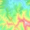
Yangana topographic map

Click on the map to display elevation.

About this map
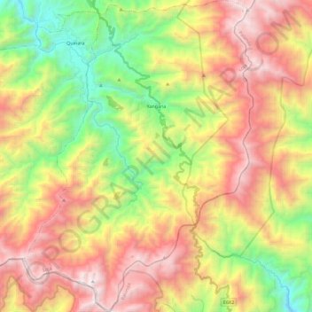
Name: Yangana topographic map, elevation, terrain.

Location: Yangana, Loja, 110160, Ecuador (-4.51148 -79.27279 -4.28924 -79.10748)

Average elevation: 8,127 ft

Minimum elevation: 4,724 ft

Maximum elevation: 11,923 ft

Other topographic maps

Click on a map to view its topography, its elevation and its terrain.
Loja

Ecuador > Loja > Loja

Across the road from University Park is the botanical garden which is open to the public and the oldest in Ecuador, created in 1949. There are over 800 native and exotic species. It is a living laboratory for scientific research and environmental education. It covers an area of 7 hectares divided into 5…

Average elevation: 7,516 ft
Santorum

Ecuador > Loja > Loja > Vilcabamba

Average elevation: 5,269 ft

Mollepamba

Ecuador > Loja > Loja > Vilcabamba

Average elevation: 6,024 ft

Santiago

Ecuador > Loja > Loja > Santiago

Average elevation: 7,887 ft

Numba

Ecuador > Loja > Loja > San Pedro de Vilcabamba

Average elevation: 7,470 ft

Cresta de Gallo

Ecuador > Loja > Loja > Vilcabamba

Average elevation: 11,020 ft

Taxiche

Ecuador > Loja > Loja > Malacatos

Average elevation: 5,285 ft

Gear up for your next adventure:

📡GPS Antenna Upgrade - Enhance GPS reception in remote terrain
🪶Survival Guide Book - Expert advice for emergency preparedness
🎒Trail Energy Bars - High‑calorie bars for hiking energy
🍳Camping Cook Set - Complete cookware for outdoor meals
🪶Multi‑Purpose Knife - Useful blade for camp and trail

As an Amazon Associate, this site earns from qualifying purchases at no extra cost to you.