Geolocate

Yeldu topographic map

Click on the map to display elevation.

About this map

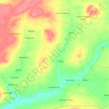
Name: Yeldu topographic map, elevation, terrain.

Location: Yeldu, Arewa Dandi, Kebbi State, Nigeria (12.74006 4.15735 12.91835 4.34149)

Average elevation: 804 ft

Minimum elevation: 682 ft

Maximum elevation: 955 ft

Other topographic maps

Click on a map to view its topography, its elevation and its terrain.

Bwi

Nigeria > Kebbi State > Arewa Dandi > Bui

Average elevation: 725 ft

Yaldu

Nigeria > Kebbi State > Arewa Dandi > Yeldu

Average elevation: 751 ft

Gear up for your next adventure:

🏕️Family Camping Gear - Essentials for group camping trips
🩹Survival Bandages - High‑quality bandages for emergencies
🛠️Outdoor Gear Repair Kit - Essential tools to fix gear on the trail
🔦LED Headlamp - Bright and durable LED headlamp for night navigation
🕶️GPS Smartphone Mount - Secure mount for phone navigation

As an Amazon Associate, this site earns from qualifying purchases at no extra cost to you.