Geolocate

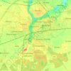
Sulin topographic map

Click on the map to display elevation.

About this map

Name: Sulin topographic map, elevation, terrain.

Location: Sulin, gmina Kłecko, Gniezno County, Greater Poland Voivodeship, 62-271, Poland (52.55211 17.41881 52.59211 17.45881)

Average elevation: 381 ft

Minimum elevation: 331 ft

Maximum elevation: 404 ft

Other topographic maps

Click on a map to view its topography, its elevation and its terrain.
Gear up for your next adventure:

👟Trail Running Shoes - Lightweight shoes for trail runners
🎒Outdoor Daypacks - Lightweight backpacks designed for carrying maps and essential gear
😴Insulated Sleeping Pads - Compact and warm pads for high-elevation camping
🌡️Handheld Weather Meters - Measure wind, temp, and pressure for safe mountain travel
🧭GPS Watch Accessories - Bands and chargers for GPS watches

As an Amazon Associate, this site earns from qualifying purchases at no extra cost to you.