Geolocate

Blue Mountain topographic map

Click on the map to display elevation.

About this map

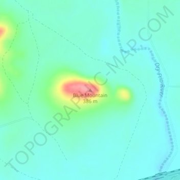
Name: Blue Mountain topographic map, elevation, terrain.

Location: Blue Mountain, Uvalde County, Texas, 78870, United States (29.30352 -99.66760 29.30362 -99.66750)

Average elevation: 1,017 ft

Minimum elevation: 951 ft

Maximum elevation: 1,270 ft

Uvalde County trails, hiking, mountain biking, running and outdoor activities

Other topographic maps

Click on a map to view its topography, its elevation and its terrain.

Uvalde

United States > Texas > Uvalde County

Average elevation: 919 ft

Onion Creek

United States > Texas > Uvalde County

Average elevation: 1,339 ft

Sabinal

United States > Texas > Uvalde County

Average elevation: 948 ft

Gear up for your next adventure:

🪶Camping Sleeping Pad - Comfortable sleeping pad for backpacking
🔭Stargazing Telescopes - Perfect for camping in low-light pollution areas shown on maps
🗻Climbing Gear Basics - Essential gear for beginner climbers
GPS Sports Watch - GPS watch for running, hiking and training
🪓Survival Multi‑Tool - Versatile tool for camp and trail tasks

As an Amazon Associate, this site earns from qualifying purchases at no extra cost to you.