Geolocate

Jacobsburg topographic map

Click on the map to display elevation.

About this map

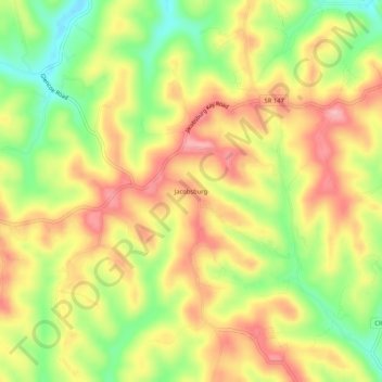
Name: Jacobsburg topographic map, elevation, terrain.

Location: Jacobsburg, Belmont County, Ohio, 43933, United States (39.94507 -80.92426 39.98507 -80.88426)

Average elevation: 1,168 ft

Minimum elevation: 925 ft

Maximum elevation: 1,371 ft

Belmont County trails, hiking, mountain biking, running and outdoor activities

Other topographic maps

Click on a map to view its topography, its elevation and its terrain.

Neffs

United States > Ohio > Belmont County > Neffs

Average elevation: 984 ft

Morristown

United States > Ohio > Belmont County

Average elevation: 1,227 ft

Flushing

United States > Ohio > Belmont County

Average elevation: 1,198 ft

Holloway

United States > Ohio > Belmont County

Average elevation: 1,027 ft

Brookside

United States > Ohio > Belmont County

Average elevation: 922 ft

Bridgeport

United States > Ohio > Belmont County

Average elevation: 801 ft

Bethesda

United States > Ohio > Belmont County

Average elevation: 1,234 ft

Belmont

United States > Ohio > Belmont County

Average elevation: 1,184 ft

Martins Ferry

United States > Ohio > Belmont County

Average elevation: 945 ft

Powhatan Point

United States > Ohio > Belmont County

Average elevation: 791 ft

Shadyside

United States > Ohio > Belmont County

Average elevation: 804 ft

Yorkville

United States > Ohio > Belmont County

Average elevation: 840 ft

Piedmont Lake

United States > Ohio > Belmont County

Average elevation: 1,053 ft

Gear up for your next adventure:

🍳Camping Cook Set - Complete cookware for outdoor meals
🚁Photography Drones - Capture stunning aerial views of landforms and topography
🪶Trail Camera - Capture wildlife on your hikes
🌎3D Topographic Globes - Raised relief globes for a tactile understanding of geography
🌡️Handheld Weather Meters - Measure wind, temp, and pressure for safe mountain travel

As an Amazon Associate, this site earns from qualifying purchases at no extra cost to you.