Geolocate

Taghum topographic map

Click on the map to display elevation.

About this map

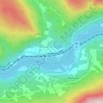
Name: Taghum topographic map, elevation, terrain.

Location: Taghum, Area F (Kokanee Range), Regional District of Central Kootenay, British Columbia, V1L 6X4, Canada (49.47185 -117.41495 49.51185 -117.37495)

Average elevation: 2,444 ft

Minimum elevation: 1,722 ft

Maximum elevation: 4,403 ft

Other topographic maps

Click on a map to view its topography, its elevation and its terrain.

Gear up for your next adventure:

🗻Climbing Gear Basics - Essential gear for beginner climbers
🔊Portable Camp Speaker - Music and alerts at camp
🪶Trail Camera - Capture wildlife on your hikes
🌧️Backpack Rain Cover - Keep gear dry in wet weather
🧤Tactile Hiking Gloves - Keep hands warm while operating GPS and smartphone screens

As an Amazon Associate, this site earns from qualifying purchases at no extra cost to you.