Geolocate

Frøya topographic map

Click on the map to display elevation.

About this map
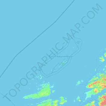
Name: Frøya topographic map, elevation, terrain.

Location: Frøya, Trøndelag, Norway (63.59815 7.64810 64.54729 9.73186)

Average elevation: 13 ft

Minimum elevation: -3 ft

Maximum elevation: 1,562 ft

Other topographic maps

Click on a map to view its topography, its elevation and its terrain.
Sandstad

Norway > Trøndelag

Average elevation: 108 ft

Rørvik

Norway > Trøndelag

Average elevation: 102 ft

Hopla

Norway > Trøndelag

Average elevation: 210 ft

Ekker

Norway > Trøndelag

Average elevation: 574 ft

Kråklivollen

Norway > Trøndelag

Average elevation: 1,627 ft

Gear up for your next adventure:

🔭Telescopic Hiking Pole - Adjustable pole for hiking stability
🕶️Glacier Sunglasses - Side shields to protect eyes from high-altitude snow glare
🥇GPS Hiking Watch - Multi‑sport GPS watch with navigation and trail tracking
🌧️Backpack Rain Cover - Keep gear dry in wet weather
🪶Compact Camp Shovel - Folding shovel for campsite tasks

As an Amazon Associate, this site earns from qualifying purchases at no extra cost to you.