Geolocate

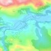
Panes topographic map

Click on the map to display elevation.

Panes

La villa de Panes, es la capital del concejo y está situada a una altitud media de 50 metros.

Wikipedia (CC-BY-SA 3.0)

About this map

Name: Panes topographic map, elevation, terrain.

Location: Panes, Peñamellera Baja, Asturias, España (43.28654 -4.60971 43.33191 -4.54494)

Average elevation: 948 ft

Minimum elevation: 39 ft

Maximum elevation: 2,848 ft

Other topographic maps

Click on a map to view its topography, its elevation and its terrain.

Lles

España > Asturias > Peñamellera Baja

Average elevation: 817 ft

Narganes

España > Asturias > Peñamellera Baja > Narganes

Average elevation: 571 ft

Bores

España > Asturias > Peñamellera Baja > Bores

Average elevation: 1,125 ft

Tobes

España > Asturias > Peñamellera Baja

Average elevation: 988 ft

Panes

España > Asturias > Peñamellera Baja

Average elevation: 643 ft

Bores

España > Asturias > Peñamellera Baja

Average elevation: 1,125 ft

Gear up for your next adventure:

🎒Outdoor Daypacks - Lightweight backpacks designed for carrying maps and essential gear
💧Water Purification System - Clean water on the trail with reliable purifiers
📻Weather Alert Radios - Stay informed of storm risks while off-the-grid
🌲Outdoor Survival Books - Best books on survival skills
🎒Gear Packing Cubes - Organize your backpack efficiently

As an Amazon Associate, this site earns from qualifying purchases at no extra cost to you.