Geolocate

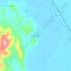
Tacagua topographic map

Click on the map to display elevation.

About this map

Name: Tacagua topographic map, elevation, terrain.

Location: Tacagua, Viacha, Ingavi, La Paz, Bolivia (-16.78239 -68.33864 -16.77826 -68.33467)

Average elevation: 12,740 ft

Minimum elevation: 12,661 ft

Maximum elevation: 13,497 ft

Other topographic maps

Click on a map to view its topography, its elevation and its terrain.

Chonchocoro

Bolivia > La Paz > Ingavi > Viacha

Average elevation: 12,762 ft

Choquenaira

Bolivia > La Paz > Ingavi > Viacha

Average elevation: 12,753 ft

Chonchocoro

Bolivia > La Paz > Ingavi > Viacha

Average elevation: 12,762 ft

Chonchocoro

Bolivia > La Paz > Ingavi > Viacha

Average elevation: 12,762 ft

Mazo Cruz

Bolivia > La Paz > Ingavi > Viacha

Average elevation: 12,989 ft

Choquenaira

Bolivia > La Paz > Ingavi > Viacha

Average elevation: 12,753 ft

Gear up for your next adventure:

🎒Waterproof Dry Bags - Keep your electronics and maps dry inside your pack
🧣Merino Neck Gaiters - Multi-functional headwear for wind and sun protection
🪶Thermal Camp Blanket - Extra warmth for cold nights
🔭Stargazing Telescopes - Perfect for camping in low-light pollution areas shown on maps
🧺Microfiber Travel Towels - Compact and fast-drying towels for trail use

As an Amazon Associate, this site earns from qualifying purchases at no extra cost to you.