
Pittsgrove Township topographic map
Interactive map
Click on the map to display elevation.
About this map
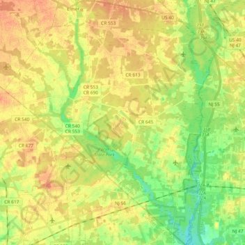
Name: Pittsgrove Township topographic map, elevation, terrain.
Location: Pittsgrove Township, Salem County, New Jersey, United States (39.45758 -75.21995 39.59913 -75.06190)
Average elevation: 98 ft
Minimum elevation: 33 ft
Maximum elevation: 148 ft
Other topographic maps
Click on a map to view its topography, its elevation and its terrain.
Pilesgrove Township
United States > New Jersey > Salem County
Pilesgrove Township, Salem County, New Jersey, 25481, United States
Average elevation: 95 ft
Penns Grove
United States > New Jersey > Salem County
Penns Grove, Salem County, New Jersey, United States
Average elevation: 13 ft
Penn Beach
United States > New Jersey > Salem County > Pennsville Township
Penn Beach, Pennsville Township, Salem County, New Jersey, 08070, United States
Average elevation: 10 ft
Carneys Point
United States > New Jersey > Salem County > Carneys Point Township
Carneys Point, Carneys Point Township, Salem County, New Jersey, 08069, United States
Average elevation: 13 ft
Central Park
United States > New Jersey > Salem County > Pennsville Township
Central Park, Pennsville Township, Salem County, New Jersey, 08070, United States
Average elevation: 7 ft
Centerton
United States > New Jersey > Salem County > Pittsgrove Township
Centerton, Pittsgrove Township, Salem County, New Jersey, 08318, United States
Average elevation: 98 ft
Seven Stars
United States > New Jersey > Salem County > Pilesgrove Township
Seven Stars, Pilesgrove Township, Salem County, New Jersey, 08098, United States
Average elevation: 69 ft
Elmer
United States > New Jersey > Salem County
Elmer, Salem County, New Jersey, United States
Average elevation: 118 ft
Paradise Lakes
United States > New Jersey > Salem County > Alloway Township
Paradise Lakes, Alloway Township, Salem County, New Jersey, 08001, United States
Average elevation: 85 ft
Alloway
United States > New Jersey > Salem County > Alloway Township
Alloway, Alloway Township, Salem County, New Jersey, 08001, United States
Average elevation: 33 ft
Cedar Crest Manor
United States > New Jersey > Salem County > Carneys Point Township > Cedar Crest Manor
Cedar Crest Manor, Carneys Point Township, Salem County, New Jersey, 08023, United States
Average elevation: 13 ft
Golf View
United States > New Jersey > Salem County > Carneys Point Township > Carneys Point > Golf View
Golf View, Carneys Point, Carneys Point Township, Salem County, New Jersey, 08069, United States
Average elevation: 13 ft
Salem
United States > New Jersey > Salem County > Salem
Salem, Salem County, New Jersey, United States
Average elevation: 7 ft
Pennsville Township
United States > New Jersey > Salem County
Pennsville Township, Salem County, New Jersey, United States
Average elevation: 10 ft
Woodstown
United States > New Jersey > Salem County
Woodstown, Salem County, New Jersey, 08098, United States
Average elevation: 52 ft