
Arena topographic map
Click on the map to display elevation.
About this map
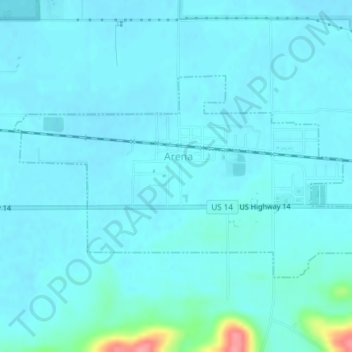
Name: Arena topographic map, elevation, terrain.
Location: Arena, Iowa County, Wisconsin, United States (43.15615 -89.93019 43.17183 -89.89272)
Average elevation: 755 ft
Minimum elevation: 722 ft
Maximum elevation: 1,024 ft
Iowa County trails, hiking, mountain biking, running and outdoor activities
Other topographic maps
Click on a map to view its topography, its elevation and its terrain.
Blue Mound State Park
United States > Wisconsin > Iowa County > Town of Brigham
Average elevation: 1,365 ft
Tower Hill State Park
United States > Wisconsin > Iowa County > Spring Green
Average elevation: 764 ft
Governor Dodge State Park
United States > Wisconsin > Iowa County > Town of Dodgeville
Average elevation: 1,102 ft