Geolocate

Sattal topographic map

Click on the map to display elevation.

About this map

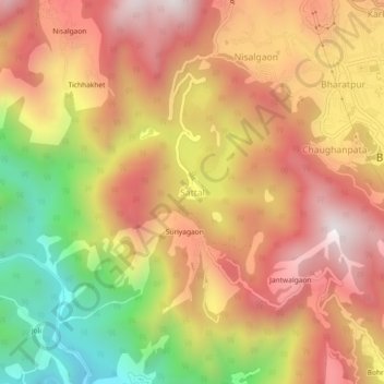
Name: Sattal topographic map, elevation, terrain.

Location: Sattal, Nainital, Uttarakhand, 263136, India (29.32696 79.50986 29.36696 79.54986)

Average elevation: 4,334 ft

Minimum elevation: 2,379 ft

Maximum elevation: 5,758 ft

Other topographic maps

Click on a map to view its topography, its elevation and its terrain.

Sariyatal

India > Uttarakhand > Nainital > Char Khet > Sariya

Average elevation: 6,161 ft

Gear up for your next adventure:

📦Dry Bags Set - Waterproof storage for electronics and clothes
🛰️Satellite Messengers - Emergency SOS and two-way messaging for off-grid adventures
🚪Portable Camp Chair - Foldable chair for comfort at camp
🥩Freeze-Dried Meals - Nutritious and lightweight food for remote expeditions
📻Weather Alert Radios - Stay informed of storm risks while off-the-grid

As an Amazon Associate, this site earns from qualifying purchases at no extra cost to you.