Geolocate

Nelleva topographic map

Click on the map to display elevation.

About this map

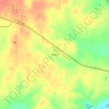
Name: Nelleva topographic map, elevation, terrain.

Location: Nelleva, Brazos County, Texas, 77866, United States (30.43465 -96.20635 30.47465 -96.16635)

Average elevation: 276 ft

Minimum elevation: 174 ft

Maximum elevation: 338 ft

Brazos County trails, hiking, mountain biking, running and outdoor activities

Other topographic maps

Click on a map to view its topography, its elevation and its terrain.

College Station

United States > Texas > Brazos County

Average elevation: 285 ft

Bryan

United States > Texas > Brazos County

Average elevation: 302 ft

College Station

United States > Texas > Brazos County

Average elevation: 285 ft

Bryan

United States > Texas > Brazos County

Average elevation: 302 ft

Bryan

United States > Texas > Brazos County

Average elevation: 302 ft

Bryan

United States > Texas > Brazos County

Average elevation: 302 ft

College Station

United States > Texas > Brazos County

Average elevation: 285 ft

Gear up for your next adventure:

🥾Men's Hiking Boots - Durable, waterproof footwear for rugged terrain and steep inclines
🏥Hiking First Aid Kits - Comprehensive medical kits for remote trail injuries
🧴Hand Sanitizer - Keep hands clean while hiking
🌎3D Topographic Globes - Raised relief globes for a tactile understanding of geography
🥤Water Filter Bottle - All‑in‑one filter bottle for safe hydration

As an Amazon Associate, this site earns from qualifying purchases at no extra cost to you.