Geolocate

Borbon topographic map

Click on the map to display elevation.

About this map

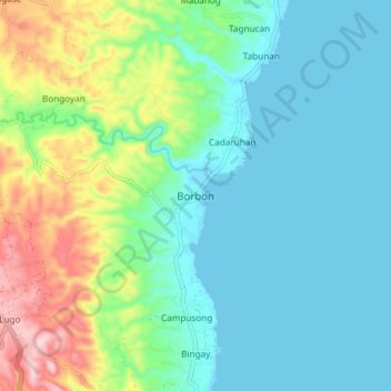
Name: Borbon topographic map, elevation, terrain.

Location: Borbon, Cebu, Central Visayas, Philippines (10.79788 123.98973 10.87788 124.06973)

Average elevation: 233 ft

Minimum elevation: 0 ft

Maximum elevation: 922 ft

Gear up for your next adventure:

🌡️Portable Weather Meter - Track weather conditions on the trail
🧭Map Reading Tools - Tools and kits for map navigation
🗺️NatGeo Topo Maps - High-quality waterproof printed topographic maps of US Parks
💧Water Filtration Bottles - Safely drink from streams and lakes while exploring
🦶Hiking Gaiters - Keep debris and water out of your boots

As an Amazon Associate, this site earns from qualifying purchases at no extra cost to you.