Geolocate

Edmund topographic map

Click on the map to display elevation.

About this map

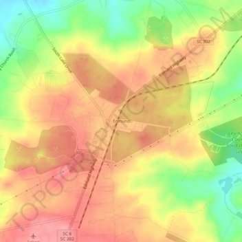
Name: Edmund topographic map, elevation, terrain.

Location: Edmund, Lexington County, South Carolina, United States (33.84146 -81.21973 33.88146 -81.17973)

Average elevation: 413 ft

Minimum elevation: 226 ft

Maximum elevation: 535 ft

Lexington County trails, hiking, mountain biking, running and outdoor activities

Other topographic maps

Click on a map to view its topography, its elevation and its terrain.

Irmo

United States > South Carolina > Lexington County

Average elevation: 308 ft

Chapin

United States > South Carolina > Lexington County

Average elevation: 436 ft

Gilbert

United States > South Carolina > Lexington County

Average elevation: 538 ft

Irmo

United States > South Carolina > Lexington County

Average elevation: 308 ft

Irmo

United States > South Carolina > Lexington County

Average elevation: 308 ft

Chapin

United States > South Carolina > Lexington County

Average elevation: 436 ft

Pelion

United States > South Carolina > Lexington County

Average elevation: 420 ft

Gear up for your next adventure:

🧭Hiking Compass - Precision compass for reliable navigation in the wilderness
🗺️NatGeo Topo Maps - High-quality waterproof printed topographic maps of US Parks
🥄Camping Utensil Set - Lightweight utensils for outdoor meals
GPS Sports Watch - GPS watch for running, hiking and training
🪶Compact Camp Shovel - Folding shovel for campsite tasks

As an Amazon Associate, this site earns from qualifying purchases at no extra cost to you.