Geolocate

Sugar Grove topographic map

Click on the map to display elevation.
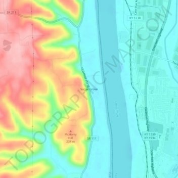
About this map

Name: Sugar Grove topographic map, elevation, terrain.

Location: Sugar Grove, Harrison County, Indiana, United States (38.09785 -85.93108 38.13785 -85.89108)

Average elevation: 561 ft

Minimum elevation: 400 ft

Maximum elevation: 873 ft

Harrison County trails, hiking, mountain biking, running and outdoor activities

Other topographic maps

Click on a map to view its topography, its elevation and its terrain.

Lanesville

United States > Indiana > Harrison County

Average elevation: 784 ft

New Amsterdam

United States > Indiana > Harrison County

Average elevation: 495 ft

New Middletown

United States > Indiana > Harrison County

Average elevation: 705 ft

Crandall

United States > Indiana > Harrison County

Average elevation: 712 ft

Laconia

United States > Indiana > Harrison County

Average elevation: 659 ft

Gear up for your next adventure:

🧭GPS Watch Accessories - Bands and chargers for GPS watches
💧Water Purification System - Clean water on the trail with reliable purifiers
🧦Hiking Socks - Comfortable socks to prevent blisters on long hikes
🔭Stargazing Telescopes - Perfect for camping in low-light pollution areas shown on maps
🛠️Outdoor Gear Repair Kit - Essential tools to fix gear on the trail

As an Amazon Associate, this site earns from qualifying purchases at no extra cost to you.