
Elmore topographic map
Click on the map to display elevation.
About this map
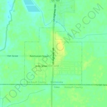
Name: Elmore topographic map, elevation, terrain.
Location: Elmore, Faribault County, Minnesota, United States (43.50001 -94.09819 43.51584 -94.07813)
Average elevation: 1,119 ft
Minimum elevation: 1,089 ft
Maximum elevation: 1,152 ft
Faribault County trails, hiking, mountain biking, running and outdoor activities
Other topographic maps
Click on a map to view its topography, its elevation and its terrain.