Geolocate

Huntley topographic map

Click on the map to display elevation.

About this map

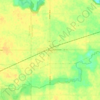
Name: Huntley topographic map, elevation, terrain.

Location: Huntley, Faribault County, Minnesota, 56047, United States (43.71162 -94.25746 43.75162 -94.21746)

Average elevation: 1,093 ft

Minimum elevation: 1,027 ft

Maximum elevation: 1,125 ft

Faribault County trails, hiking, mountain biking, running and outdoor activities

Other topographic maps

Click on a map to view its topography, its elevation and its terrain.

Minnesota Lake

United States > Minnesota > Faribault County

Average elevation: 1,043 ft

Wells

United States > Minnesota > Faribault County

Average elevation: 1,158 ft

Walters

United States > Minnesota > Faribault County

Average elevation: 1,234 ft

Kiester

United States > Minnesota > Faribault County

Average elevation: 1,237 ft

Delavan

United States > Minnesota > Faribault County

Average elevation: 1,066 ft

Easton

United States > Minnesota > Faribault County

Average elevation: 1,053 ft

Elmore

United States > Minnesota > Faribault County

Average elevation: 1,119 ft

Frost

United States > Minnesota > Faribault County

Average elevation: 1,122 ft

Bricelyn

United States > Minnesota > Faribault County

Average elevation: 1,171 ft

Blue Earth

United States > Minnesota > Faribault County

Average elevation: 1,079 ft

Gear up for your next adventure:

🩹Survival Bandages - High‑quality bandages for emergencies
🕶️Glacier Sunglasses - Side shields to protect eyes from high-altitude snow glare
🔭Compact Binoculars - HD vision for scouting terrain and identifying distant landmarks
🔪Outdoor Multitools - Essential survival tools for gear repair and field use
🥾Men's Hiking Boots - Durable, waterproof footwear for rugged terrain and steep inclines

As an Amazon Associate, this site earns from qualifying purchases at no extra cost to you.