Geolocate

Waverley topographic map

Click on the map to display elevation.

About this map

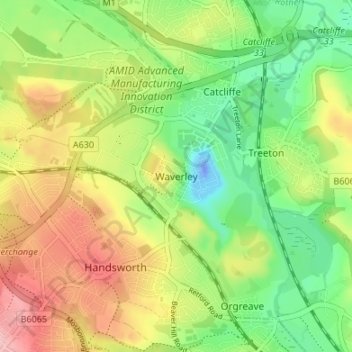
Name: Waverley topographic map, elevation, terrain.

Location: Waverley, Rotherham, South Yorkshire, England, S60 8AH, United Kingdom (53.36262 -1.39140 53.40262 -1.35140)

Average elevation: 213 ft

Minimum elevation: -125 ft

Maximum elevation: 486 ft

Other topographic maps

Click on a map to view its topography, its elevation and its terrain.

Wickersley

United Kingdom > England > Rotherham

Average elevation: 381 ft

Thrybergh

United Kingdom > England > Rotherham

Average elevation: 157 ft

Thurcroft

United Kingdom > England > Rotherham

Average elevation: 364 ft

Ulley

United Kingdom > England > Rotherham

Average elevation: 302 ft

Hellaby

United Kingdom > England > Rotherham

With a Dutch impression that was influenced by the style common in the colonies, the Hall was built on a hill and hence an extra storey was required to obtain the height at the front elevation.

Average elevation: 371 ft

Walkworth Wood

United Kingdom > England > Rotherham

Average elevation: 325 ft

Thorpe Salvin

United Kingdom > England > Rotherham

Thorpe Salvin is a village and a civil parish in the Metropolitan Borough of Rotherham in South Yorkshire, England, on the border with Nottinghamshire. It lies between Worksop and Harthill, and is located at an elevation of around 110 metres above sea level. At the 2011 Census, it had a population of 476, down…

Average elevation: 335 ft

Firbeck

United Kingdom > England > Rotherham

Average elevation: 203 ft

Wentworth

United Kingdom > England > Rotherham

Average elevation: 315 ft

Woodsetts

United Kingdom > England > Rotherham

Woodsetts is a village and civil parish in the Metropolitan Borough of Rotherham in South Yorkshire, England, on the border with Nottinghamshire. It lies between the towns of Dinnington and Worksop at an elevation of around 60 metres above sea level, and has a population of 1,746 at the 2011 Census. The…

Average elevation: 230 ft

Waverley

United Kingdom > England > Rotherham

Average elevation: 190 ft

Orgreave

United Kingdom > England > Rotherham

Average elevation: 187 ft

Bramley

United Kingdom > England > Rotherham

Average elevation: 400 ft

Ravenfield

United Kingdom > England > Rotherham

Average elevation: 282 ft

Dalton

United Kingdom > England > Rotherham > Dalton Magna

Average elevation: 328 ft

Todwick

United Kingdom > England > Rotherham > Todwick

Average elevation: 344 ft

Brampton Bierlow

United Kingdom > England > Rotherham > Brampton

Average elevation: 180 ft

Gear up for your next adventure:

🎒Day Hiking Backpack - Lightweight backpack perfect for day trips and outdoor adventures
🥄Camping Utensil Set - Lightweight utensils for outdoor meals
🏕️Tent Footprint - Protect your tent base from wear
📶Satellite Messenger - Communication device off‑grid
Backpacking Tents - Weight-optimized shelters for multi-day topographic surveys

As an Amazon Associate, this site earns from qualifying purchases at no extra cost to you.