Geolocate

Brandon topographic map

Click on the map to display elevation.

About this map

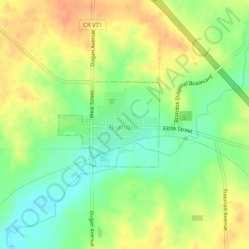
Name: Brandon topographic map, elevation, terrain.

Location: Brandon, Buchanan County, Iowa, United States (42.31007 -92.01184 42.31934 -91.99691)

Average elevation: 869 ft

Minimum elevation: 797 ft

Maximum elevation: 935 ft

Buchanan County trails, hiking, mountain biking, running and outdoor activities

Other topographic maps

Click on a map to view its topography, its elevation and its terrain.

Littleton

United States > Iowa > Buchanan County

Average elevation: 951 ft

Gear up for your next adventure:

🌲Outdoor Survival Books - Best books on survival skills
🪶Multi‑Purpose Knife - Useful blade for camp and trail
🌄Hiking Binoculars - Compact binoculars for scenic views and trail spotting
🪶Wildlife Field Guides - Learn animal tracking and species ID
🔪Outdoor Multitools - Essential survival tools for gear repair and field use

As an Amazon Associate, this site earns from qualifying purchases at no extra cost to you.