Milton topographic map
Interactive map
Click on the map to display elevation.
About this map
![Milton topographic map, elevation, terrain](/pub/maps/relation/l2nh/l74qs8/thumbnail.jpg)
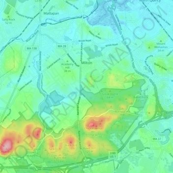
Name: Milton topographic map, elevation, terrain.
Location: Milton, Norfolk County, Massachusetts, United States (42.20071 -71.13075 42.27810 -71.03142)
Average elevation: 135 ft
Minimum elevation: -7 ft
Maximum elevation: 620 ft
Massachusett, the indigenous name for the Great Blue Hill, was the largest of the cluster of hills along the southern coast of Massachusetts Bay. As the second-highest elevation in all of Eastern America directly on the Atlantic coast, it possessed a sacred status in the religion of the Massachusett people. Beyond being a sacred site, the various hills were mined extensively by the indigenous inhabitants due to the abundance of a type of rare stone formed by the volcanic eruption of Massachusett 200 million years ago that was highly favorable for stone tools. These tools were traded among the indigenous people of the Northeast due to the rarity of the stone. This also indicates that the trade networks of the indigenous Northeast were far more expansive than previously thought.
Other topographic maps
Click on a map to view its topography, its elevation and its terrain.
![Quincy topographic map, elevation, terrain](/pub/maps/relation/kns8/24bxcz/icon.jpg)
Quincy
United States > Massachusetts > Norfolk County
Quincy, Norfolk County, Massachusetts, United States
Average elevation: 62 ft
![Needham topographic map, elevation, terrain](/pub/maps/relation/nxrr/4zq9gp/icon.jpg)
Needham
United States > Massachusetts > Norfolk County
Needham, Norfolk County, Massachusetts, United States
Average elevation: 151 ft
![Dedham topographic map, elevation, terrain](/pub/maps/relation/d5z4/vh6srr/icon.jpg)
Dedham
United States > Massachusetts > Norfolk County
Dedham, Norfolk County, Massachusetts, United States
Average elevation: 141 ft
![Babel Rock topographic map, elevation, terrain](/pub/maps/node/7ntf/nr1fct6/icon.jpg)
Babel Rock
United States > Massachusetts > Norfolk County > Quincy
Babel Rock, Quincy, Norfolk County, Massachusetts, 02269, United States
Average elevation: 151 ft
![Houghs Neck topographic map, elevation, terrain](/pub/maps/node/xdkl/t96t1cz/icon.jpg)
Houghs Neck
United States > Massachusetts > Norfolk County > Quincy
Houghs Neck, Quincy, Norfolk County, Massachusetts, 02191, United States
Average elevation: 7 ft
![Norwood topographic map, elevation, terrain](/pub/maps/relation/m7cz/v8ckrr/icon.jpg)
Norwood
United States > Massachusetts > Norfolk County
Norwood, Norfolk County, Massachusetts, 02062, United States
Average elevation: 121 ft
![Germantown topographic map, elevation, terrain](/pub/maps/node/w63l/zs8g9nx/icon.jpg)
Germantown
United States > Massachusetts > Norfolk County > Quincy
Germantown, Quincy, Norfolk County, Massachusetts, 02191, United States
Average elevation: 16 ft
![Braintree topographic map, elevation, terrain](/pub/maps/relation/6rnh/dgmn4s/icon.jpg)
Braintree
United States > Massachusetts > Norfolk County
Braintree, Norfolk County, Massachusetts, 02184, United States
Average elevation: 128 ft
![Canton topographic map, elevation, terrain](/pub/maps/relation/kjnh/dg3r4s/icon.jpg)
Canton
United States > Massachusetts > Norfolk County
Canton, Norfolk County, Massachusetts, United States
Average elevation: 144 ft
![Avon topographic map, elevation, terrain](/pub/maps/relation/b24s/87p51h/icon.jpg)
Avon
United States > Massachusetts > Norfolk County
Avon, Norfolk County, Massachusetts, 02322, United States
Average elevation: 197 ft
![Wrentham topographic map, elevation, terrain](/pub/maps/relation/94z4/x8ds5k/icon.jpg)
Wrentham
United States > Massachusetts > Norfolk County
Wrentham, Norfolk County, Massachusetts, 02093, United States
Average elevation: 256 ft
![South Quincy topographic map, elevation, terrain](/pub/maps/node/hhm2/nkf433q/icon.jpg)
South Quincy
United States > Massachusetts > Norfolk County > Quincy
South Quincy, Quincy, Norfolk County, Massachusetts, 02269, United States
Average elevation: 82 ft
![Cohasset topographic map, elevation, terrain](/pub/maps/relation/pwcz/v8jgrr/icon.jpg)
Cohasset
United States > Massachusetts > Norfolk County
Cohasset, Norfolk County, Massachusetts, 02025, United States
Average elevation: 26 ft
![Rock Island topographic map, elevation, terrain](/pub/maps/node/fttp/t9l8gcz/icon.jpg)
Rock Island
United States > Massachusetts > Norfolk County > Quincy
Rock Island, Quincy, Norfolk County, Massachusetts, 02191, United States
Average elevation: 10 ft
![Westwood topographic map, elevation, terrain](/pub/maps/relation/39rr/m6tbtp/icon.jpg)
Westwood
United States > Massachusetts > Norfolk County
Westwood, Norfolk County, Massachusetts, 02090, United States
Average elevation: 194 ft
![Buckmaster Pond topographic map, elevation, terrain](/pub/maps/way/4s3q/x6fdf4s/icon.jpg)
Buckmaster Pond
United States > Massachusetts > Norfolk County > Westwood
Buckmaster Pond, Westwood, Norfolk County, Massachusetts, United States
Average elevation: 220 ft
![East Weymouth topographic map, elevation, terrain](/pub/maps/node/9db3/lzg55tp/icon.jpg)
East Weymouth
United States > Massachusetts > Norfolk County > Weymouth
East Weymouth, Weymouth, Norfolk County, Massachusetts, 02189, United States
Average elevation: 69 ft
![Houghton's Pond topographic map, elevation, terrain](/pub/maps/way/dt6/f54wkf3/icon.jpg)
Houghton's Pond
United States > Massachusetts > Norfolk County > Milton
Houghton's Pond, Milton, Norfolk County, Massachusetts, United States
Average elevation: 249 ft
![Blue Hills topographic map, elevation, terrain](/pub/maps/node/8xgp/71rnl18/icon.jpg)
Blue Hills
United States > Massachusetts > Norfolk County > Milton
Blue Hills, Milton, Norfolk County, Massachusetts, 01286, United States
Average elevation: 105 ft
![Wethersfield topographic map, elevation, terrain](/pub/maps/node/6fnh/sqxp3mt/icon.jpg)
Wethersfield
United States > Massachusetts > Norfolk County > Bellingham
Wethersfield, Bellingham, Norfolk County, Massachusetts, 02019, United States
Average elevation: 249 ft
![Brookline topographic map, elevation, terrain](/pub/maps/way/p3tj/2ltlprr/icon.jpg)
Brookline
United States > Massachusetts > Norfolk County
Brookline, Norfolk County, Massachusetts, United States, Olmsted Park
Average elevation: 92 ft
![Medway topographic map, elevation, terrain](/pub/maps/relation/fcgt/hq2gmt/icon.jpg)
Medway
United States > Massachusetts > Norfolk County
Medway, Norfolk County, Massachusetts, 02053, United States
Average elevation: 197 ft
![Great Blue Hill topographic map, elevation, terrain](/pub/maps/node/mqgp/f8s583q/icon.jpg)
Great Blue Hill
United States > Massachusetts > Norfolk County > Canton
Great Blue Hill, Canton, Norfolk County, Massachusetts, 02187, United States
Average elevation: 246 ft
![Medfield topographic map, elevation, terrain](/pub/maps/relation/drgp/lvhcf3/icon.jpg)
Medfield
United States > Massachusetts > Norfolk County
Medfield, Norfolk County, Massachusetts, 02052, United States
Average elevation: 187 ft
![Quincy Point topographic map, elevation, terrain](/pub/maps/node/4jrr/lzgj6gp/icon.jpg)
Quincy Point
United States > Massachusetts > Norfolk County > Quincy
Quincy Point, Quincy, Norfolk County, Massachusetts, 02169, United States
Average elevation: 39 ft
![Oakdale topographic map, elevation, terrain](/pub/maps/node/gr5k/kvcx2b3/icon.jpg)
Oakdale
United States > Massachusetts > Norfolk County > Dedham
Oakdale, Dedham, Norfolk County, Massachusetts, 02026, United States
Average elevation: 95 ft
![Ashcroft topographic map, elevation, terrain](/pub/maps/node/hfrr/9n29z4s/icon.jpg)
Ashcroft
United States > Massachusetts > Norfolk County > Dedham
Ashcroft, Dedham, Norfolk County, Massachusetts, 02026, United States
Average elevation: 98 ft
![Brookline topographic map, elevation, terrain](/pub/maps/relation/6j9m/7w2jtf/icon.jpg)
Brookline
United States > Massachusetts > Norfolk County
Brookline, Norfolk County, Massachusetts, United States
Average elevation: 115 ft
![Blue Hills Reservation topographic map, elevation, terrain](/pub/maps/relation/n951/dt8j18/icon.jpg)
Blue Hills Reservation
United States > Massachusetts > Norfolk County > Quincy
Blue Hills Reservation, Quincy, Norfolk County, Massachusetts, United States
Average elevation: 157 ft
![Weymouth Heights topographic map, elevation, terrain](/pub/maps/node/xw57/kv2vnb3/icon.jpg)
Weymouth Heights
United States > Massachusetts > Norfolk County > Weymouth
Weymouth Heights, Weymouth, Norfolk County, Massachusetts, 02191, United States
Average elevation: 49 ft
![Wellesley topographic map, elevation, terrain](/pub/maps/relation/1kcz/hqjkgt/icon.jpg)
Wellesley
United States > Massachusetts > Norfolk County
Wellesley, Norfolk County, Massachusetts, United States
Average elevation: 171 ft
![Bellingham topographic map, elevation, terrain](/pub/maps/relation/gxb3/4zn4tp/icon.jpg)
Bellingham
United States > Massachusetts > Norfolk County > Bellingham
Bellingham, Norfolk County, Massachusetts, 02019, United States
Average elevation: 276 ft
![Stoughton topographic map, elevation, terrain](/pub/maps/relation/lqgp/lvtjf3/icon.jpg)
Stoughton
United States > Massachusetts > Norfolk County > Stoughton
Stoughton, Norfolk County, Massachusetts, United States
Average elevation: 217 ft
![Boston Harbor Islands National Recreation Area topographic map, elevation, terrain](/pub/maps/relation/d5s8/pnsfnx/icon.jpg)
Boston Harbor Islands National Recreation Area
United States > Massachusetts > Norfolk County > Weymouth
Boston Harbor Islands National Recreation Area, Weymouth, Norfolk County, Massachusetts, United States
Average elevation: 3 ft
![Weymouth topographic map, elevation, terrain](/pub/maps/relation/4brr/m61ztp/icon.jpg)
Weymouth
United States > Massachusetts > Norfolk County
Weymouth, Norfolk County, Massachusetts, United States
Average elevation: 92 ft
![Plainville topographic map, elevation, terrain](/pub/maps/relation/p73q/r9bscz/icon.jpg)
Plainville
United States > Massachusetts > Norfolk County
Plainville, Norfolk County, Massachusetts, 02762, United States
Average elevation: 259 ft
![Medfield topographic map, elevation, terrain](/pub/maps/node/dt6/drjqsz4/icon.jpg)
Medfield
United States > Massachusetts > Norfolk County
Medfield, Norfolk County, Massachusetts, 02052, United States
Average elevation: 197 ft
![Walpole topographic map, elevation, terrain](/pub/maps/relation/g2f3/lxmcs8/icon.jpg)
Walpole
United States > Massachusetts > Norfolk County
Walpole, Norfolk County, Massachusetts, United States
Average elevation: 203 ft
![Birds Hill topographic map, elevation, terrain](/pub/maps/node/nh3q/9nrhzzs/icon.jpg)
Birds Hill
United States > Massachusetts > Norfolk County > Needham
Birds Hill, Needham, Norfolk County, Massachusetts, 02027, United States
Average elevation: 141 ft
![Millis topographic map, elevation, terrain](/pub/maps/relation/j8t6/dtm2kl/icon.jpg)
Millis
United States > Massachusetts > Norfolk County
Millis, Norfolk County, Massachusetts, 02054, United States
Average elevation: 167 ft
![Quincy topographic map, elevation, terrain](/pub/maps/node/g75k/3jbzwdn/icon.jpg)
Quincy
United States > Massachusetts > Norfolk County > Quincy
Quincy, Norfolk County, Massachusetts, 02169, United States
Average elevation: 92 ft
![Franklin topographic map, elevation, terrain](/pub/maps/relation/wbs8/k4fgt6/icon.jpg)
Franklin
United States > Massachusetts > Norfolk County > Franklin
Franklin, Norfolk County, Massachusetts, United States
Average elevation: 262 ft
![Atlantic topographic map, elevation, terrain](/pub/maps/node/wb57/b4vlnt6/icon.jpg)
Atlantic
United States > Massachusetts > Norfolk County > Quincy > Atlantic
Atlantic, Quincy, Norfolk County, Massachusetts, 02171, United States
Average elevation: 23 ft
![North Commons topographic map, elevation, terrain](/pub/maps/node/4j51/lzbk4tp/icon.jpg)
North Commons
United States > Massachusetts > Norfolk County > Quincy
North Commons, Quincy, Norfolk County, Massachusetts, 02269, United States
Average elevation: 85 ft
![Sabrina Lake topographic map, elevation, terrain](/pub/maps/relation/plcz/sht8f3/icon.jpg)
Sabrina Lake
United States > Massachusetts > Norfolk County > Wellesley
Sabrina Lake, Wellesley, Norfolk County, Massachusetts, United States
Average elevation: 148 ft
![Corey Hill topographic map, elevation, terrain](/pub/maps/node/lks8/7ldz2rr/icon.jpg)
Corey Hill
United States > Massachusetts > Norfolk County > Brookline
Corey Hill, Brookline, Norfolk County, Massachusetts, 02446, United States
Average elevation: 98 ft
![Randolph topographic map, elevation, terrain](/pub/maps/node/bzt6/wprjxtf/icon.jpg)
Randolph
United States > Massachusetts > Norfolk County > Randolph > Randolph
Randolph, Norfolk County, Massachusetts, 02368, United States
Average elevation: 190 ft
![Medway topographic map, elevation, terrain](/pub/maps/node/sn18/fcqc9nh/icon.jpg)
Medway
United States > Massachusetts > Norfolk County > Medway > Medway
Medway, Norfolk County, Massachusetts, 02053, United States
Average elevation: 207 ft
![City Mills topographic map, elevation, terrain](/pub/maps/node/8p51/v7sfdtj/icon.jpg)
City Mills
United States > Massachusetts > Norfolk County > Norfolk > City Mills
City Mills, Norfolk, Norfolk County, Massachusetts, 02056-1409, United States
Average elevation: 217 ft
![Norfolk topographic map, elevation, terrain](/pub/maps/relation/z6t6/dt8hkl/icon.jpg)
Norfolk
United States > Massachusetts > Norfolk County
Norfolk, Norfolk County, Massachusetts, 02056, United States
Average elevation: 210 ft