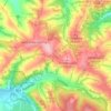
Zakopane topographic map
Click on the map to display elevation.
Zakopane
Zakopane has a humid continental climate (Köppen climate classification: Dfb), with the main factor behind its relative coldness compared to the rest of Poland is its altitude. In general, the temperature tends to fall with altitude, therefore Zakopane is almost 3 °C (5.4 °F) colder than northern Kraków, which is more than 600 m (2,000 ft) lower than Zakopane. With higher altitudes, the climate gets even colder, therefore, on the top of Kasprowy Wierch (1,987 m (6,519 ft) above sea level), the climate is tundra-like (Köppen: ET). The tree line is located at about 1,500 m (4,900 ft) above sea level in the Tatra Mountains.
About this map
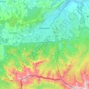
Name: Zakopane topographic map, elevation, terrain.
Location: Zakopane, Tatra County, Lesser Poland Voivodeship, Poland (49.21835 19.90039 49.33317 20.04316)
Average elevation: 3,871 ft
Minimum elevation: 2,434 ft
Maximum elevation: 7,382 ft
Other topographic maps
Click on a map to view its topography, its elevation and its terrain.

Kondratova kopa / Kopa Kondracka
Poland > Lesser Poland Voivodeship > Tatra County > Zakopane
Kopa Kondracka (Slovak: Kondratova kopa) is a mountain in the Western Tatras mountain range, situated on the main ridge of the Tatras east of Małołączniak, on the border between Poland and Slovakia. It's the easternmost of the four summits making up the Czerwone Wierchy massif, as well as the lowest, with…
Average elevation: 5,466 ft
Rysy
Poland > Lesser Poland Voivodeship > Tatra County > Brzegi
It is possible to reach the peak from the Slovak side, starting at Štrbské pleso and passing Chata pod Rysmi, a mountain chalet at an altitude of 2,250 m (7,380 ft). Between November 1 and June 1, the trail and chalet on the Slovak side are closed.
Average elevation: 6,578 ft

Rysy
Poland > Lesser Poland Voivodeship > Tatra County > Brzegi
It is possible to reach the peak from the Slovak side, starting at Štrbské pleso and passing Chata pod Rysmi, a mountain chalet at an altitude of 2,250 m (7,380 ft). Between November 1 and June 15, the trail and chalet on the Slovak side are closed.
Average elevation: 6,578 ft
Tatry
Poland > Lesser Poland Voivodeship > Tatra County > Zakopane
The Tatras lie in the temperate zone of Central Europe. They are an important barrier to the movements of air masses. Their mountainous topography causes one of the most diverse climates in that region.
Average elevation: 5,404 ft
Morskie Oko
Poland > Lesser Poland Voivodeship > Tatra County > Brzegi
Morskie Oko at the foothill of Tatra Mountains in southern Poland which average 2,000 metres (6,600 ft) in elevation
Average elevation: 5,738 ft


Czarny Staw Polski
Poland > Lesser Poland Voivodeship > Tatra County > Brzegi
Average elevation: 5,938 ft
Rysy
Poland > Lesser Poland Voivodeship > Tatra County > Brzegi
It is possible to reach the peak from the Slovak side, starting at Štrbské pleso and passing Chata pod Rysmi, a mountain chalet at an altitude of 2,250 m (7,380 ft). Between November 1 and June 1, the trail and chalet on the Slovak side are closed.
Average elevation: 6,578 ft
Wielki Giewont
Poland > Lesser Poland Voivodeship > Tatra County > Zakopane
Average elevation: 4,849 ft
Wielki Giewont
Poland > Lesser Poland Voivodeship > Tatra County > Zakopane
Average elevation: 4,849 ft
Gęsia Szyja
Poland > Lesser Poland Voivodeship > Tatra County > Małe Ciche
Average elevation: 4,245 ft
Kaniówka
Poland > Lesser Poland Voivodeship > Tatra County > Białka Tatrzańska
Average elevation: 2,605 ft
Stasindowie
Poland > Lesser Poland Voivodeship > Tatra County > Gliczarów Górny
Average elevation: 2,933 ft