
Thank you for supporting this site ❤️
Make a donation
Make a donation
Gear up for your next adventure:
As an Amazon Associate, this site earns from qualifying purchases at no extra cost to you.
Trasquera topographic map
Click on the map to display elevation.
Thank you for supporting this site ❤️
Make a donation
Make a donation
Gear up for your next adventure:
As an Amazon Associate, this site earns from qualifying purchases at no extra cost to you.
About this map
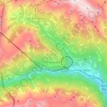
Name: Trasquera topographic map, elevation, terrain.
Location: Trasquera, Verbano-Cusio-Ossola, Piedmont, 28868, Italy (46.17631 8.13888 46.26473 8.23618)
Average elevation: 5,164 ft
Minimum elevation: 1,407 ft
Maximum elevation: 9,534 ft
Thank you for supporting this site ❤️
Make a donation
Make a donation
Gear up for your next adventure:
As an Amazon Associate, this site earns from qualifying purchases at no extra cost to you.
Other topographic maps
Click on a map to view its topography, its elevation and its terrain.