Geolocate

El Corraón topographic map

Click on the map to display elevation.

About this map
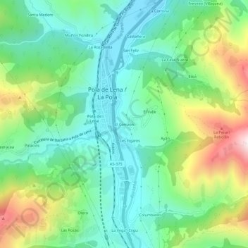
Name: El Corraón topographic map, elevation, terrain.

Location: El Corraón, La Pola, Lena, Asturias, 33630, Spain (43.13653 -5.84439 43.17653 -5.80439)

Average elevation: 1,657 ft

Minimum elevation: 902 ft

Maximum elevation: 3,320 ft

Other topographic maps

Click on a map to view its topography, its elevation and its terrain.

Chanos de Somerón

Spain > Asturias > Lena

Average elevation: 3,232 ft

Congostinas

Spain > Asturias > Lena

Average elevation: 3,310 ft

Zurea

Spain > Asturias > Lena

Average elevation: 2,661 ft

Gear up for your next adventure:

🛡️Insect Repellent - Protection against bugs during outdoor activities
🌡️Handheld Weather Meters - Measure wind, temp, and pressure for safe mountain travel
🎒Gear Packing Cubes - Organize your backpack efficiently
🔦Powerful Headlamps - Ultra-bright hands-free lighting for night navigation
🌲Outdoor Survival Books - Best books on survival skills

As an Amazon Associate, this site earns from qualifying purchases at no extra cost to you.