Geolocate

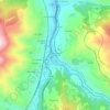
Congostinas topographic map

Click on the map to display elevation.

About this map

Name: Congostinas topographic map, elevation, terrain.

Location: Congostinas, Lena, Asturias, 33694, Spain (43.08484 -5.78740 43.11804 -5.71469)

Average elevation: 3,310 ft

Minimum elevation: 1,430 ft

Maximum elevation: 5,397 ft

Other topographic maps

Click on a map to view its topography, its elevation and its terrain.

Piedracea

Spain > Asturias > Lena

Average elevation: 1,962 ft

Corneyana

Spain > Asturias > Lena

Average elevation: 1,909 ft

Gear up for your next adventure:

🔭Telescopic Hiking Pole - Adjustable pole for hiking stability
🪵Folding Camp Saw - Compact saw for wood and campsite work
🧢Outdoor Hiking Hat - Sun protection hat for outdoor explorers
🧥Men's Rain Shells - Premium waterproof and breathable jackets for mountain weather
🗺️Topographic Maps - Detailed topo maps for hiking, exploring and outdoor navigation

As an Amazon Associate, this site earns from qualifying purchases at no extra cost to you.