Geolocate

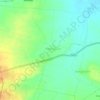
Katrabai topographic map

Click on the map to display elevation.

About this map

Name: Katrabai topographic map, elevation, terrain.

Location: Katrabai, Akola, Ahilyanagar District, Maharashtra, India (19.48363 73.71283 19.48373 73.71293)

Average elevation: 3,409 ft

Minimum elevation: 1,490 ft

Maximum elevation: 4,603 ft

Other topographic maps

Click on a map to view its topography, its elevation and its terrain.

Nizampur

India > Maharashtra > Akola

Average elevation: 919 ft

Hingna Barling

India > Maharashtra > Akola

Average elevation: 938 ft

Kothari

India > Maharashtra > Akola

Average elevation: 981 ft

Nawakheda

India > Maharashtra > Akola

Average elevation: 886 ft

Pahadpur

India > Maharashtra > Akola

Average elevation: 981 ft

Dongargaon

India > Maharashtra > Akola > Dongargaon

Average elevation: 965 ft

Babhulgaon

India > Maharashtra > Akola > Babhulgaon

Average elevation: 965 ft

Borgaon Manju

India > Maharashtra > Akola

Average elevation: 968 ft

Umerkhed

India > Maharashtra > Akola

Average elevation: 932 ft

Gear up for your next adventure:

🧭Hiking Compass - Precision compass for reliable navigation in the wilderness
👟Trail Running Shoes - Lightweight shoes for trail runners
🪶LED Camping Lantern - Bright lantern for camp lighting
🛠️Backpacking Tool Kit - Essential toolkit for outdoor repairs
📡Handheld GPS Device - Reliable handheld GPS for outdoor navigation

As an Amazon Associate, this site earns from qualifying purchases at no extra cost to you.