
Make a donation
Gear up for your next adventure:
As an Amazon Associate, this site earns from qualifying purchases at no extra cost to you.
Borgaon Manju topographic map
Click on the map to display elevation.
Make a donation
Gear up for your next adventure:
As an Amazon Associate, this site earns from qualifying purchases at no extra cost to you.
About this map
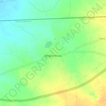
Name: Borgaon Manju topographic map, elevation, terrain.
Average elevation: 968 ft
Minimum elevation: 912 ft
Maximum elevation: 1,017 ft
Make a donation
Gear up for your next adventure:
As an Amazon Associate, this site earns from qualifying purchases at no extra cost to you.
Other topographic maps
Click on a map to view its topography, its elevation and its terrain.
Kalasubai peak
India > Maharashtra > Akola
Kalsubai (Marathi: कळसूबाई शिखर) is a mountain in the Western Ghats, located in the Indian state of Maharashtra. Its summit, situated at an elevation of 1,646 metres (5,400 ft), is the highest point in Maharashtra.
Average elevation: 3,970 ft
Make a donation
Gear up for your next adventure:
As an Amazon Associate, this site earns from qualifying purchases at no extra cost to you.
Make a donation
Gear up for your next adventure:
As an Amazon Associate, this site earns from qualifying purchases at no extra cost to you.
Make a donation
Gear up for your next adventure:
As an Amazon Associate, this site earns from qualifying purchases at no extra cost to you.
Make a donation
Gear up for your next adventure:
As an Amazon Associate, this site earns from qualifying purchases at no extra cost to you.
Akole
India > Maharashtra > Akola
Kalsubai is the highest peak in Maharashtra, with an elevation of 1,646 meters (5,400 feet). Ghatghar, located 22 kilometers (14 miles) from Bhandardara, offers views of the Sahyadri range and is the site of the Udanchan Hydro-power project's first installation, which has a capacity of 250 MW. Additionally,…
Average elevation: 2,457 ft
Make a donation
Gear up for your next adventure:
As an Amazon Associate, this site earns from qualifying purchases at no extra cost to you.
Kalasubai peak
India > Maharashtra > Akola
Kalsubai (Marathi: कळसूबाई शिखर) is a mountain in the Western Ghats, located in the Indian state of Maharashtra. Its summit, situated at an elevation of 1,646 metres (5,400 ft), is the highest point in Maharashtra.
Average elevation: 3,970 ft
Make a donation
Gear up for your next adventure:
As an Amazon Associate, this site earns from qualifying purchases at no extra cost to you.