
Guanaba topographic map
Click on the map to display elevation.
Guanaba
The eastern boundary of Guanaba follows the Coomera River. Tamborine National Park occupies a section in the west where elevations reach to around 40 metres (130 ft) above sea level.
About this map
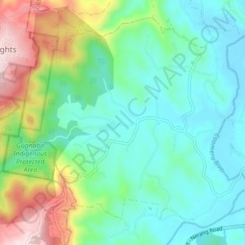
Name: Guanaba topographic map, elevation, terrain.
Location: Guanaba, Gold Coast City, Queensland, Australia (-27.96169 153.20659 -27.91486 153.26857)
Average elevation: 505 ft
Minimum elevation: 43 ft
Maximum elevation: 1,745 ft
Other topographic maps
Click on a map to view its topography, its elevation and its terrain.