
Pine Ridge Conservation Park topographic map
Click on the map to display elevation.
About this map
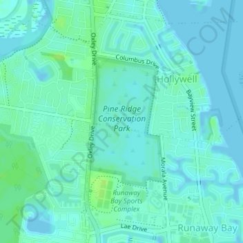
Name: Pine Ridge Conservation Park topographic map, elevation, terrain.
Average elevation: 13 ft
Minimum elevation: -10 ft
Maximum elevation: 36 ft
Other topographic maps
Click on a map to view its topography, its elevation and its terrain.
Tomewin Conservation Park
Australia > Queensland > Gold Coast City > Tomewin
Average elevation: 755 ft
Guanaba
Australia > Queensland > Gold Coast City
The eastern boundary of Guanaba follows the Coomera River. Tamborine National Park occupies a section in the west where elevations reach to around 40 metres (130 ft) above sea level.
Average elevation: 505 ft