Geolocate

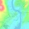
Carrigaholt topographic map

Click on the map to display elevation.

About this map

Name: Carrigaholt topographic map, elevation, terrain.

Location: Carrigaholt, Rahona ED, West Clare Municipal District, County Clare, Munster, Ireland (52.59333 -9.71806 52.61333 -9.69806)

Average elevation: 36 ft

Minimum elevation: 0 ft

Maximum elevation: 141 ft

Other topographic maps

Click on a map to view its topography, its elevation and its terrain.

Lahinch

Ireland > County Clare

Average elevation: 115 ft

Killaloe

Ireland > County Clare > Killaloe

Average elevation: 190 ft

Doonass

Ireland > County Clare

Average elevation: 92 ft

Kilfenora

Ireland > County Clare

Average elevation: 230 ft

Corofin

Ireland > County Clare

Average elevation: 79 ft

Clooney

Ireland > County Clare

Average elevation: 187 ft

Mountallon

Ireland > County Clare

Average elevation: 105 ft

Gear up for your next adventure:

🎁Geography Themed Gifts - Unique gift ideas for map lovers and geography enthusiasts
🦺Reflective Outdoor Gear - Safety gear for low‑light conditions
📶Vehicle Signal Boosters - Improve reception in rural areas while driving to trailheads
🛰️Handheld GPS Units - Professional satellite navigators for precise backcountry mapping
😴Insulated Sleeping Pads - Compact and warm pads for high-elevation camping

As an Amazon Associate, this site earns from qualifying purchases at no extra cost to you.