

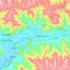
Nyingchi topographic map
Click on the map to display elevation.
About this map
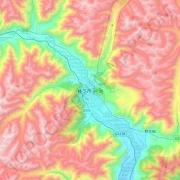
Name: Nyingchi topographic map, elevation, terrain.
Average elevation: 13,238 ft
Minimum elevation: 9,629 ft
Maximum elevation: 16,890 ft
Other topographic maps
Click on a map to view its topography, its elevation and its terrain.

Gyirong Town
China > Xizang > Gyirong County
Gyirong or Kyirong (Tibetan: སྐྱིད་གྲོང་, Wylie: skyid grong, THL: kyi rong), Jilong in Chinese (Chinese: 吉隆鎮; pinyin: Jílóng zhèn) and Kerung in Nepalese (Nepali: केरुङ), is a town situated in the southern part of Gyirong County in the Tibet Autonomous Region, China.…
Average elevation: 13,625 ft
Kyirong Township
China > Xizang > Gyirong County
Kyirong or Gyirong (Tibetan: སྐྱིད་གྲོང་, Wylie: skyid grong, THL: kyi rong), Jilong in Chinese (Chinese: 吉隆鎮; pinyin: Jílóng zhèn) and Kerung in Nepalese (Nepali: केरुङ), is a town situated in the southern part of Gyirong County in the Tibet Autonomous Region, China.…
Average elevation: 13,730 ft


Lhasa
Lhasa prefecture-level city roughly corresponds to the basin of the Lhasa River, a major tributary of the Yarlung Tsangpo. Exceptions are the north of Damxung County, which crosses the watershed of the Nyenchen Tanglha Mountains and includes part of the Namtso lake, and Nyêmo County, which covers the basin of…
Average elevation: 15,971 ft
Tholing town
China > Xizang > Tsamda County
Recent maps only use the Zanda name, and not Tholing. Zanda sits at an elevation of 3,660 metres (12,010 ft). There are caves in the hills, and a few ruins of chortens located closer to the Sutlej River; the ruins are mostly destroyed but the murals are in very good condition. There are a few poplar trees in…
Average elevation: 15,541 ft

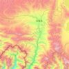
Dzongka Town
China > Xizang > Gyirong County
Dzongka lies at an altitude of 4,130 metres (13,550 ft) in the valley of Kyirong Tsangpo near the confluence of its two source streams, Zarong Chu and Gyang Chu.
Average elevation: 16,329 ft
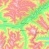

Shuanghu County
Shuanghu County (Chinese: 双湖县), also transliterated from Tibetan as Tsonyi County or Co Nyi County (Tibetan: མཚོ་གཉིས་རྫོང་།), is a county under the jurisdiction of the prefecture-level city of Nagqu, in the northernmost part of the Tibet Autonomous Region, China. It was…
Average elevation: 16,453 ft
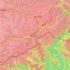
Mainling City
Mainling is located in the central-west of the Nyingtri Prefecture, at the middle reaches of the Yarlung Tsangpo River, and between the Nyenchen Tanglha Mountains and the Himalayan Mountains. It de jure covers an area of 9,490 square kilometres, including the area claimed but de facto under control of the…
Average elevation: 11,847 ft

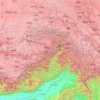
Nyingchi Prefecture
The average elevation of Nyingchi is 3,040 meters (9,974 feet), which is the lowest compared with the other prefectures in Tibet. The relatively low elevation compared to other regions of the Tibetan plateau yields a lower risk of altitude sickness. Guangdong province announced in 2012 that it plans to invest…
Average elevation: 11,342 ft
Lhasa
Lhasa prefecture-level city roughly corresponds to the basin of the Lhasa River, a major tributary of the Yarlung Tsangpo. Exceptions are the north of Damxung County, which crosses the watershed of the Nyenchen Tanglha Mountains and includes part of the Namtso lake, and Nyêmo County, which covers the basin of…
Average elevation: 15,965 ft
Lhasa
Lhasa prefecture-level city roughly corresponds to the basin of the Lhasa River, a major tributary of the Yarlung Tsangpo. Exceptions are the north of Damxung County, which crosses the watershed of the Nyenchen Tanglha Mountains and includes part of the Namtso lake, and Nyêmo County, which covers the basin of…
Average elevation: 15,971 ft
Lhasa
Lhasa prefecture-level city roughly corresponds to the basin of the Lhasa River, a major tributary of the Yarlung Tsangpo. Exceptions are the north of Damxung County, which crosses the watershed of the Nyenchen Tanglha Mountains and includes part of the Namtso lake, and Nyêmo County, which covers the basin of…
Average elevation: 15,965 ft
Chengguan District
Lhasa is the second most populous urban area on the Tibetan Plateau after Xining and, at an altitude of 3,656 metres (11,990 ft), Lhasa is one of the highest cities in the world. The city has been the religious and administrative capital of Tibet since the mid-17th century. It contains many culturally…
Average elevation: 14,190 ft