
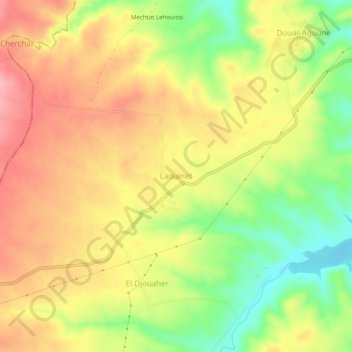
Laouinet topographic map
Interactive map
Click on the map to display elevation.
About this map
Name: Laouinet topographic map, elevation, terrain.
Average elevation: 2,995 ft
Minimum elevation: 2,776 ft
Maximum elevation: 3,179 ft
Other topographic maps
Click on a map to view its topography, its elevation and its terrain.
Douar Ouled Belhouchet
Algérie > Bordj Bou Arreridj > Daïra Ain Taghrout > Tixter
Douar Ouled Belhouchet, Tixter, Daïra Ain Taghrout, Bordj Bou Arreridj, Algérie
Average elevation: 2,969 ft
Aïn Taghrout
Algérie > Bordj Bou Arreridj > Daïra Ain Taghrout > Aïn Taghrout
Aïn Taghrout, Daïra Ain Taghrout, Bordj Bou Arreridj, Algérie
Average elevation: 3,074 ft
Tixter
Algérie > Bordj Bou Arreridj > Daïra Ain Taghrout > Tixter
Tixter, Daïra Ain Taghrout, Bordj Bou Arreridj, Algérie
Average elevation: 3,261 ft