
Thank you for supporting this site ❤️
Make a donation
Make a donation
Gear up for your next adventure:
As an Amazon Associate, this site earns from qualifying purchases at no extra cost to you.
Chaurjahari topographic map
Click on the map to display elevation.
Thank you for supporting this site ❤️
Make a donation
Make a donation
Gear up for your next adventure:
As an Amazon Associate, this site earns from qualifying purchases at no extra cost to you.
About this map
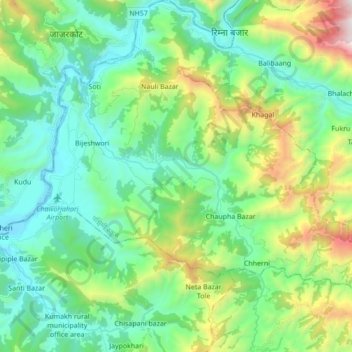
Name: Chaurjahari topographic map, elevation, terrain.
Location: Chaurjahari, Western Rukum District, Karnali Pradesh, Nepal (28.58060 82.18334 28.69283 82.35606)
Average elevation: 3,743 ft
Minimum elevation: 2,178 ft
Maximum elevation: 8,245 ft
Thank you for supporting this site ❤️
Make a donation
Make a donation
Gear up for your next adventure:
As an Amazon Associate, this site earns from qualifying purchases at no extra cost to you.