Geolocate

Hurlingham topographic map

Click on the map to display elevation.

About this map
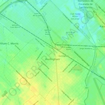
Name: Hurlingham topographic map, elevation, terrain.

Location: Hurlingham, Partido de Hurlingham, Buenos Aires, 1686, Argentina (-34.61249 -58.66017 -34.56883 -58.61641)

Average elevation: 46 ft

Minimum elevation: 7 ft

Maximum elevation: 89 ft

Other topographic maps

Click on a map to view its topography, its elevation and its terrain.

Mar del Tuyú

Argentina > Buenos Aires

Average elevation: 10 ft

Luján

Argentina > Buenos Aires

Average elevation: 82 ft

Piñeyro

Argentina > Buenos Aires

Average elevation: 715 ft

Gear up for your next adventure:

🥾Women's Hiking Boots - Top-rated trail boots with ankle support and superior grip
😴Insulated Sleeping Pads - Compact and warm pads for high-elevation camping
💧Water Purification System - Clean water on the trail with reliable purifiers
🪶Trail Camera - Capture wildlife on your hikes
🌲Outdoor Survival Books - Best books on survival skills

As an Amazon Associate, this site earns from qualifying purchases at no extra cost to you.