Geolocate

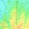
Piñeyro topographic map

Click on the map to display elevation.

About this map

Name: Piñeyro topographic map, elevation, terrain.

Location: Piñeyro, Partido de Coronel Suárez, Buenos Aires, Argentina (-37.44184 -61.75622 -37.40184 -61.71622)

Average elevation: 715 ft

Minimum elevation: 699 ft

Maximum elevation: 732 ft

Other topographic maps

Click on a map to view its topography, its elevation and its terrain.

Monte Grande

Argentina > Buenos Aires

Average elevation: 72 ft

Temperley

Argentina > Buenos Aires

Average elevation: 66 ft

Tandil

Argentina > Buenos Aires

Average elevation: 735 ft

Lanús Centro Oeste

Argentina > Buenos Aires

Average elevation: 30 ft

Junín

Argentina > Buenos Aires

Average elevation: 259 ft

Moreno

Argentina > Buenos Aires

Average elevation: 72 ft

Loma Hermosa

Argentina > Buenos Aires

Average elevation: 56 ft

Sarandí

Argentina > Buenos Aires

Average elevation: 20 ft

San Fernando

Argentina > Buenos Aires

Average elevation: 20 ft

Villa Maipú

Argentina > Buenos Aires

Average elevation: 75 ft

Aldo Bonzi

Argentina > Buenos Aires

Average elevation: 46 ft

Pergamino

Argentina > Buenos Aires

Average elevation: 233 ft

Lomas de Zamora

Argentina > Buenos Aires

Average elevation: 52 ft

Munro

Argentina > Buenos Aires > Vicente López

Average elevation: 85 ft

Villa Adelina

Argentina > Buenos Aires > Vicente López

Average elevation: 82 ft

Hurlingham

Argentina > Buenos Aires

Average elevation: 46 ft

Quilmes

Argentina > Buenos Aires

Average elevation: 36 ft

Gear up for your next adventure:

🧥Waterproof Jacket for Hiking - Breathable and rugged rain jacket for outdoor excursions
🛌Ultralight Sleeping Bags - Compact down bags for cold nights in the wilderness
🎒Hydration Pack - Hands‑free water reservoir for long hikes
🔥Camping Stove - Portable stove for camping and backcountry cooking
🦟Ultrasonic Repellers - Create a bug-free zone at your camp or rest stop

As an Amazon Associate, this site earns from qualifying purchases at no extra cost to you.