
Ramsey Lake topographic map
Interactive map
Click on the map to display elevation.
About this map
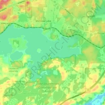
Name: Ramsey Lake topographic map, elevation, terrain.
Average elevation: 883 ft
Minimum elevation: 748 ft
Maximum elevation: 1,099 ft
Other topographic maps
Click on a map to view its topography, its elevation and its terrain.
Sudbury
Canada > Ontario > Greater Sudbury
Sudbury, Greater Sudbury, Sudbury District, Ontario, Canada
Average elevation: 892 ft
Wanapitei Lake
Canada > Ontario > Greater Sudbury
Wanapitei Lake, MacLennan Drive, Greater Sudbury, Ontario, Canada
Average elevation: 892 ft
Flake
Canada > Ontario > Greater Sudbury
Flake, Greater Sudbury, Sudbury District, Northeastern Ontario, Ontario, P3N 1B4, Canada
Average elevation: 932 ft