
Make a donation
Gear up for your next adventure:
As an Amazon Associate, this site earns from qualifying purchases at no extra cost to you.
Bar Elias topographic map
Click on the map to display elevation.
Make a donation
Gear up for your next adventure:
As an Amazon Associate, this site earns from qualifying purchases at no extra cost to you.
About this map
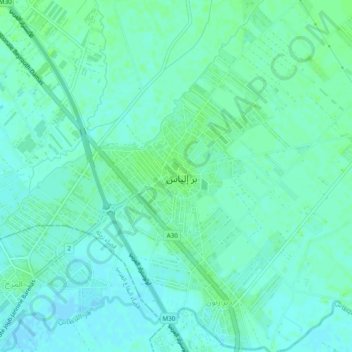
Name: Bar Elias topographic map, elevation, terrain.
Location: Bar Elias, Zahlé District, Beqaa Governorate, Lebanon (33.73435 35.86439 33.81435 35.94439)
Average elevation: 2,867 ft
Minimum elevation: 2,835 ft
Maximum elevation: 3,228 ft
Make a donation
Gear up for your next adventure:
As an Amazon Associate, this site earns from qualifying purchases at no extra cost to you.
Other topographic maps
Click on a map to view its topography, its elevation and its terrain.
Make a donation
Gear up for your next adventure:
As an Amazon Associate, this site earns from qualifying purchases at no extra cost to you.
Shouf Cedar Biosphere Reserve Limit
Precipitation in the watershed is the source of both surface streamflow and groundwater. The major portion of this occurs as rain. Snowfall often occurs at the upper elevations but snow seldom persists more than a few days and disappears before the end of the rainy season. Normally snow has little overall…
Average elevation: 3,215 ft
Make a donation
Gear up for your next adventure:
As an Amazon Associate, this site earns from qualifying purchases at no extra cost to you.
Make a donation
Gear up for your next adventure:
As an Amazon Associate, this site earns from qualifying purchases at no extra cost to you.