

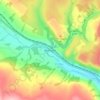
Mossdale topographic map
Click on the map to display elevation.
About this map

Name: Mossdale topographic map, elevation, terrain.
Average elevation: 236 ft
Minimum elevation: 131 ft
Maximum elevation: 636 ft
Other topographic maps
Click on a map to view its topography, its elevation and its terrain.



Wigtown
United Kingdom > Scotland > Dumfries and Galloway
Wigtown Castle was in existence by 1291, on flat land down by the River Bladnoch, (outlines clearly seen on an aerial view), whilst the town and church were on a hill, "an inversion of the usual arrangements". Nothing remains of the castle, although a strong natural site and indication of a large enclosed and…
Average elevation: 59 ft

River Cree
United Kingdom > Scotland > Dumfries and Galloway > Newton Stewart
Average elevation: 128 ft








Garden of Cosmic Speculation
United Kingdom > Scotland > Dumfries and Galloway > Burnhead
Average elevation: 102 ft
Eskdalemuir
United Kingdom > Scotland > Dumfries and Galloway
In spite of it being located inland, the dull and wet nature of the climate due to the elevation leads to chilly summers that are colder than more northerly locations such as Glasgow and Edinburgh. The inland nature of the climate is more manifest during winter months with frosts being common, and the average…
Average elevation: 807 ft


Lochmaben Castle
United Kingdom > Scotland > Dumfries and Galloway > Lochmaben
Average elevation: 157 ft












Scarhead
United Kingdom > Scotland > Dumfries and Galloway > Johnstonebridge
Average elevation: 305 ft

Dykehead
United Kingdom > Scotland > Dumfries and Galloway > Johnstonebridge
Average elevation: 381 ft














Little Richorn
United Kingdom > Scotland > Dumfries and Galloway > Dalbeattie
Average elevation: 138 ft