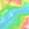
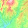
Torthorwald topographic map
Click on the map to display elevation.
About this map

Name: Torthorwald topographic map, elevation, terrain.
Average elevation: 279 ft
Minimum elevation: 10 ft
Maximum elevation: 778 ft
Other topographic maps
Click on a map to view its topography, its elevation and its terrain.



Garden of Cosmic Speculation
United Kingdom > Scotland > Dumfries and Galloway > Burnhead
Average elevation: 102 ft

Lochmaben Castle
United Kingdom > Scotland > Dumfries and Galloway > Lochmaben
Average elevation: 157 ft


Lochrutton Loch
United Kingdom > Scotland > Dumfries and Galloway > Lochfoot
Average elevation: 348 ft



Rhinns of Kellsc
United Kingdom > Scotland > Dumfries and Galloway
'Rhinns' derives from the Old Irish rind, later Ulster Irish and Scottish Gaelic rinn, meaning 'promontory' or 'point'. 'Kells' is a parish in the historic county of Stewartry of Kirkcudbright to the southeast of the range near New Galloway. Its name possibly derives from the Old Irish cell, later Irish and…
Average elevation: 1,155 ft


River Cree
United Kingdom > Scotland > Dumfries and Galloway > Newton Stewart
Average elevation: 128 ft