Geolocate

Factory Butte topographic map

Click on the map to display elevation.

About this map

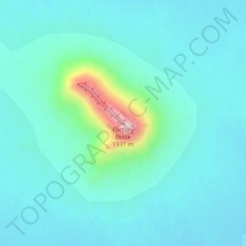
Name: Factory Butte topographic map, elevation, terrain.

Location: Factory Butte, Wayne County, Utah, United States (38.43782 -110.91442 38.43792 -110.91432)

Average elevation: 4,977 ft

Minimum elevation: 4,760 ft

Maximum elevation: 6,198 ft

Other topographic maps

Click on a map to view its topography, its elevation and its terrain.

Canyonlands National Park

United States > Utah > Wayne County

Average elevation: 5,312 ft

Teasdale

United States > Utah > Wayne County > Teasdale

Average elevation: 7,208 ft

Loa

United States > Utah > Wayne County

Average elevation: 7,080 ft

Torrey

United States > Utah > Wayne County

Average elevation: 6,857 ft

Hanksville

United States > Utah > Wayne County

Average elevation: 4,364 ft

Canyonlands National Park

United States > Utah > Wayne County

Average elevation: 5,312 ft

Gear up for your next adventure:

🏕️Family Camping Gear - Essentials for group camping trips
📱Solar Portable Charger - Solar power bank for charging devices off‑grid
🕶️Glacier Sunglasses - Side shields to protect eyes from high-altitude snow glare
🦟Ultrasonic Repellers - Create a bug-free zone at your camp or rest stop
📷Action Cameras - Rugged cameras to document your journeys across rugged terrain

As an Amazon Associate, this site earns from qualifying purchases at no extra cost to you.