
Thank you for supporting this site ❤️
Make a donation
Make a donation
Gear up for your next adventure:
As an Amazon Associate, this site earns from qualifying purchases at no extra cost to you.
Rohtang Pass topographic map
Click on the map to display elevation.
Thank you for supporting this site ❤️
Make a donation
Make a donation
Gear up for your next adventure:
As an Amazon Associate, this site earns from qualifying purchases at no extra cost to you.
About this map
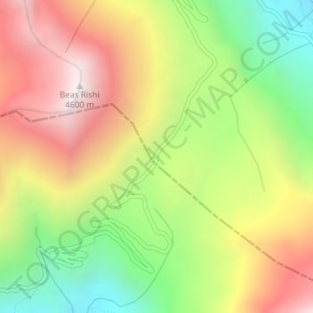
Name: Rohtang Pass topographic map, elevation, terrain.
Location: Rohtang Pass, Lahul, Lahul and Spiti, Himachal Pradesh, India (32.37095 77.24622 32.37105 77.24632)
Average elevation: 13,261 ft
Minimum elevation: 11,430 ft
Maximum elevation: 15,148 ft
Thank you for supporting this site ❤️
Make a donation
Make a donation
Gear up for your next adventure:
As an Amazon Associate, this site earns from qualifying purchases at no extra cost to you.
Other topographic maps
Click on a map to view its topography, its elevation and its terrain.