Geolocate

Payton topographic map

Interactive map

Click on the map to display elevation.

About this map

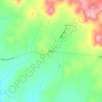
Name: Payton topographic map, elevation, terrain.

Location: Payton, Blanco County, Texas, United States (30.09382 -98.32529 30.13382 -98.28529)

Average elevation: 1,385 ft

Minimum elevation: 1,198 ft

Maximum elevation: 1,677 ft

Blanco County trails, hiking, mountain biking, running and outdoor activities

Other topographic maps

Click on a map to view its topography, its elevation and its terrain.

Blanco State Park

United States > Texas > Blanco County > Blanco

Average elevation: 1,368 ft

Johnson City

United States > Texas > Blanco County

Average elevation: 1,230 ft

Blanco

United States > Texas > Blanco County

Average elevation: 1,398 ft

Pedernales River

United States > Texas > Blanco County

Average elevation: 1,237 ft

Pedernales Falls Road

United States > Texas > Blanco County

Average elevation: 1,017 ft

Round Mountain

United States > Texas > Blanco County

Average elevation: 1,312 ft