
Murray topographic map
Click on the map to display elevation.
Murray
According to the United States Census Bureau, the city has a total area of 9.6 square miles (24.9 km2), all land. Murray is located in the heart of the Salt Lake Valley. The city is nearly built out with a broad mix of commercial, residential and industrial uses. The topography is generally gentle, sloping westward from the nearby Wasatch Mountain Range toward the Jordan River, which is the terminal river feature in the Salt Lake Valley. Murray's average altitude is approximately 1300 meters Above Sea Level, with the highest variation located near the border of Cottonwood Heights and lowest variation along the Jordan River near 4500 South Street.
About this map
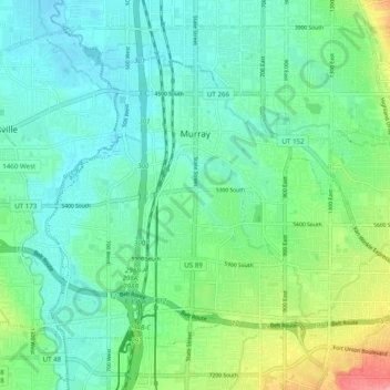
Name: Murray topographic map, elevation, terrain.
Location: Murray, Salt Lake County, Utah, 84107, United States (40.62614 -111.93207 40.68390 -111.83411)
Average elevation: 4,334 ft
Minimum elevation: 4,242 ft
Maximum elevation: 4,603 ft
Salt Lake County trails, hiking, mountain biking, running and outdoor activities
Other topographic maps
Click on a map to view its topography, its elevation and its terrain.
Jordan River OHV/ Modelport State Park
United States > Utah > Salt Lake County > Salt Lake City
Average elevation: 4,219 ft
Salt Lake City
United States > Utah > Salt Lake County > Salt Lake City
Salt Lake City has an area of 110.4 square miles (286 km2) and an average elevation of 4,327 feet (1,319 m) above sea level. The lowest point within the boundaries of the city is 4,210 feet (1,280 m) near the Jordan River and the Great Salt Lake, and the highest is Grandview Peak, at 9,410 feet (2,868 m).
Average elevation: 5,331 ft
Great Salt Lake State Park
United States > Utah > Salt Lake County > Magna
Average elevation: 4,236 ft
Draper Commercial Parkway
United States > Utah > Salt Lake County > Draper
Average elevation: 4,446 ft
Brighton
United States > Utah > Salt Lake County
Brighton has a high-altitude cold continental climate (Köppen Dsb/Dsc), with dry summers and very snowy winters.
Average elevation: 9,357 ft
Riverton Majestic Village
United States > Utah > Salt Lake County > Riverton
Average elevation: 4,491 ft
Meridian Peak
United States > Utah > Salt Lake County > Salt Lake City
Meridian Peak can be found at the southern end of Elliot Ridge Trail. It can be reached by ascending several hiking trails into the Gore Range. Surprise Lake Trail goes south for 2.6 miles to Surprise Lake, then the Gore Range Trail continues west for 1.9 miles to a junction with the Upper Cataract Lake and…
Average elevation: 5,571 ft
Silver Lake Summer Resort
United States > Utah > Salt Lake County > Brighton
Average elevation: 9,295 ft