
Wickham topographic map
Click on the map to display elevation.
About this map
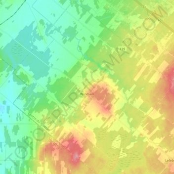
Name: Wickham topographic map, elevation, terrain.
Location: Wickham, Drummond, Centre-du-Québec, Quebec, Canada (45.70077 -72.57813 45.82811 -72.40921)
Average elevation: 341 ft
Minimum elevation: 226 ft
Maximum elevation: 525 ft