
Community Lake topographic map
Click on the map to display elevation.
About this map
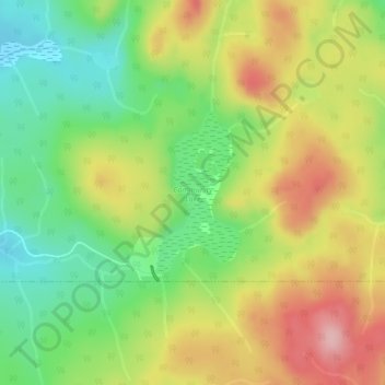
Name: Community Lake topographic map, elevation, terrain.
Average elevation: 4,590 ft
Minimum elevation: 4,341 ft
Maximum elevation: 4,888 ft
Other topographic maps
Click on a map to view its topography, its elevation and its terrain.
Mount Cahilty
Canada > British Columbia > Thompson-Nicola Regional District > Area O (Lower North Thompson)
Average elevation: 5,696 ft
Leonie Lake
Canada > British Columbia > Thompson-Nicola Regional District > Area O (Lower North Thompson)
Average elevation: 3,632 ft
Little Fort
Canada > British Columbia > Thompson-Nicola Regional District > Area O (Lower North Thompson)
Average elevation: 1,709 ft
Dagger Lake
Canada > British Columbia > Thompson-Nicola Regional District > Area O (Lower North Thompson)
Average elevation: 4,869 ft
Spectacle Lake
Canada > British Columbia > Thompson-Nicola Regional District > Area O (Lower North Thompson)
Average elevation: 4,685 ft
Dunn Peak
Canada > British Columbia > Thompson-Nicola Regional District > Area O (Lower North Thompson)
Average elevation: 6,995 ft
Spider Lake
Canada > British Columbia > Thompson-Nicola Regional District > Area O (Lower North Thompson)
Average elevation: 4,455 ft