Geolocate

Hudson topographic map

Click on the map to display elevation.

About this map

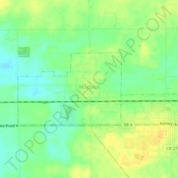
Name: Hudson topographic map, elevation, terrain.

Location: Hudson, Steuben County, Indiana, United States (41.52693 -85.09556 41.53798 -85.07264)

Average elevation: 984 ft

Minimum elevation: 942 ft

Maximum elevation: 1,024 ft

Steuben County trails, hiking, mountain biking, running and outdoor activities

Other topographic maps

Click on a map to view its topography, its elevation and its terrain.

Berlien

United States > Indiana > Steuben County

Average elevation: 1,024 ft

York

United States > Indiana > Steuben County

Average elevation: 1,050 ft

Alvarado

United States > Indiana > Steuben County

Average elevation: 958 ft

Metz

United States > Indiana > Steuben County

Average elevation: 974 ft

Pleasant Lake

United States > Indiana > Steuben County

Average elevation: 974 ft

Gear up for your next adventure:

🎒Waterproof Dry Bags - Keep your electronics and maps dry inside your pack
🧭GPS Watch Accessories - Bands and chargers for GPS watches
🛠️Backpacking Tool Kit - Essential toolkit for outdoor repairs
🪶Multi‑Purpose Knife - Useful blade for camp and trail
🧼Biodegradable Camping Soap - Eco‑friendly soap for outdoor hygiene

As an Amazon Associate, this site earns from qualifying purchases at no extra cost to you.