Geolocate

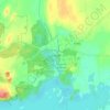
Mayo topographic map

Click on the map to display elevation.

About this map

Name: Mayo topographic map, elevation, terrain.

Location: Mayo, Claremorris-Swinford Municipal District, County Mayo, Connacht, F12 E7W7, Ireland (53.72008 -9.16581 53.80931 -9.03078)

Average elevation: 174 ft

Minimum elevation: 92 ft

Maximum elevation: 289 ft

Other topographic maps

Click on a map to view its topography, its elevation and its terrain.
Tourmakeady

Ireland > County Mayo

Average elevation: 187 ft

Mweelrea

Ireland > County Mayo

Average elevation: 1,388 ft

Cong

Ireland > County Mayo

Average elevation: 75 ft

Claremorris

Ireland > County Mayo > Claremorris

Average elevation: 220 ft

Breaghwy

Ireland > County Mayo

Average elevation: 125 ft

Newport

Ireland > County Mayo > Newport

Average elevation: 75 ft

Ballinrobe

Ireland > County Mayo > Ballinrobe

Average elevation: 105 ft

Gear up for your next adventure:

🪶Trail Camera - Capture wildlife on your hikes
🪶Survival Guide Book - Expert advice for emergency preparedness
🔦LED Headlamp - Bright and durable LED headlamp for night navigation
👟Men's Trail Runners - Lightweight footwear for fast-paced exploration and light hiking
🌄Hiking Binoculars - Compact binoculars for scenic views and trail spotting

As an Amazon Associate, this site earns from qualifying purchases at no extra cost to you.