
Villa Rendena topographic map
Click on the map to display elevation.
About this map
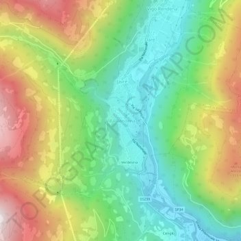
Name: Villa Rendena topographic map, elevation, terrain.
Average elevation: 3,176 ft
Minimum elevation: 1,749 ft
Maximum elevation: 5,351 ft
Other topographic maps
Click on a map to view its topography, its elevation and its terrain.
Parco naturale dell'Adamello-Brenta
Italy > Trentino-Alto Adige/Südtirol > Provincia di Trento > Carisolo
Average elevation: 6,358 ft
Val di Non
Italy > Trentino-Alto Adige/Südtirol > Provincia di Trento > Ville d'Anaunia
Average elevation: 3,245 ft
Andalo
Italy > Trentino-Alto Adige/Südtirol > Provincia di Trento > Andalo
The town lies on the Paganella plateau, between the mountains Piz Galin, elevation 2,442 metres (8,012 ft), and Paganella, 2,125 metres (6,972 ft), and its territory is part of the Adamello-Brenta natural park.
Average elevation: 4,491 ft
Castel Beseno
Italy > Trentino-Alto Adige/Südtirol > Provincia di Trento > Besenello > Sottocastello
Average elevation: 1,276 ft