
Alatri topographic map
Click on the map to display elevation.
About this map
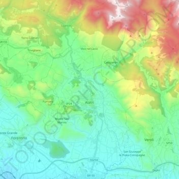
Name: Alatri topographic map, elevation, terrain.
Location: Alatri, Frosinone, Lazio, 03011, Italy (41.65428 13.28110 41.82296 13.48711)
Average elevation: 2,096 ft
Minimum elevation: 492 ft
Maximum elevation: 6,388 ft
Other topographic maps
Click on a map to view its topography, its elevation and its terrain.
Monte Cassino
Italy > Lazio > Frosinone > Cassino
Monte Cassino (today usually spelled Montecassino) is a rocky hill about 130 kilometres (80 mi) southeast of Rome, in the Latin Valley, Italy, 2 kilometres (1+1⁄4 mi) west of Cassino and at an elevation of 520 m (1,710 ft). Site of the Roman town of Casinum, it is widely known for its abbey, the first house…
Average elevation: 758 ft